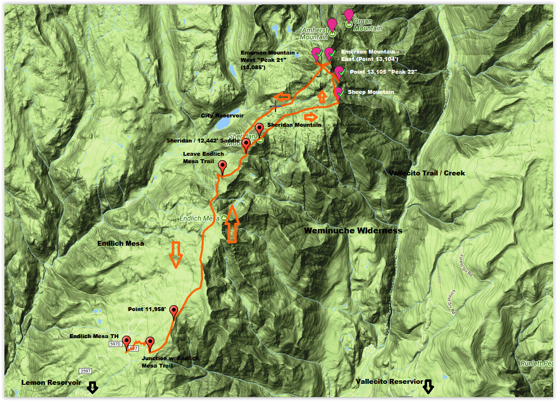
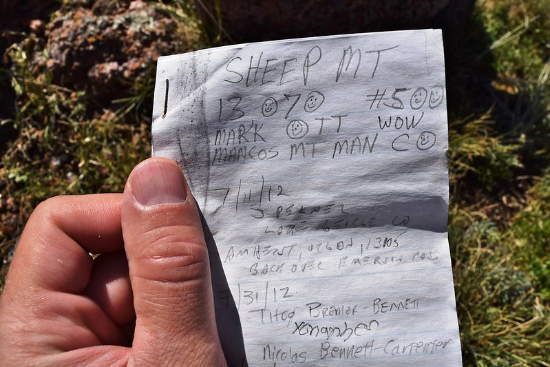
Peaks: Sheridan Mountain (12,795′), Sheep Mountain D (13,070′), Point 13,105′ (aka “Peak 22”), Emerson Mountain – West (aka “Peak 21” – 13,085′), Emerson Mountain – East (13,140′)
Date: July 17, 2017
Where: Weminuche Wilderness
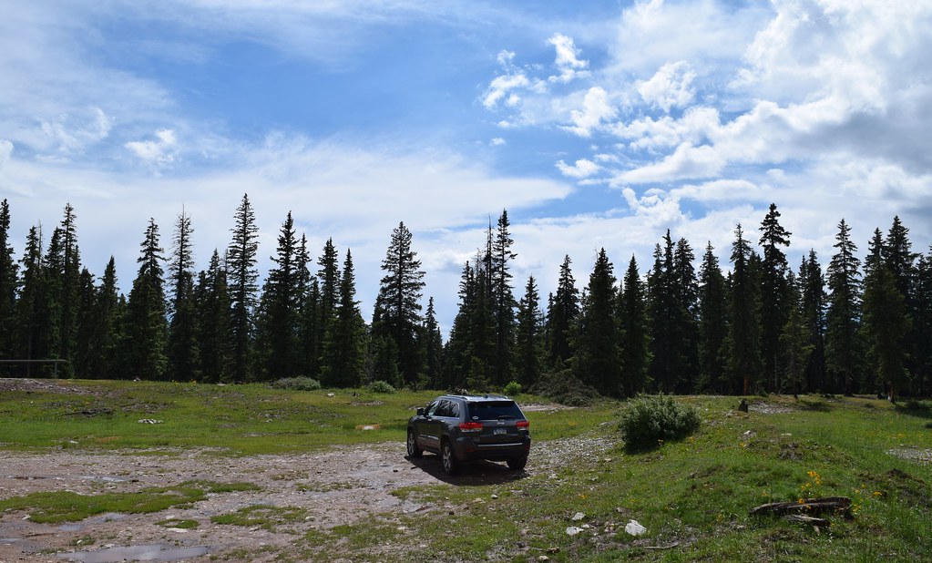
Trailhead: Endlich Mesa (11,600′)
Distance: ~ 17 miles
Elevation Gain: ~ 5,000 ft.
Participants: solo
Time: 9 hours
July 16, 2017 – The Endlich Mesa TH:
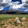
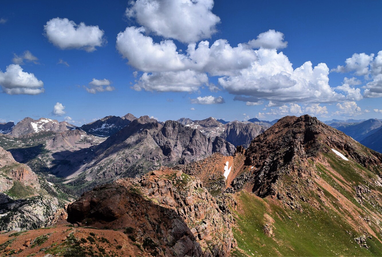
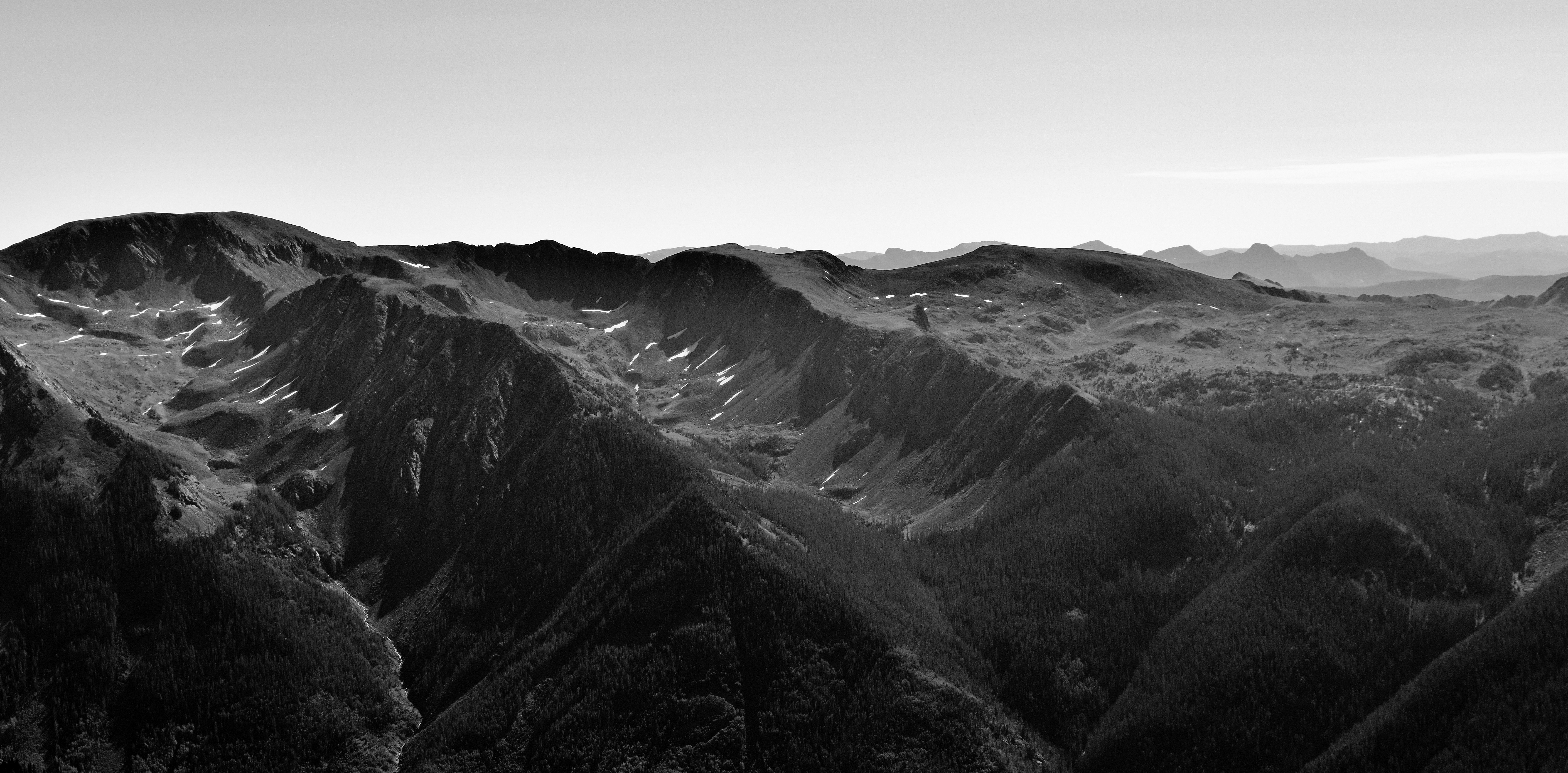
The Endlich Mesa TH sits high on the Endlich Mesa just below treeline and just outside the southern border of the Weminuche Wilderness. The trailhead itself was everything I expected it to be: a sign, some guy passing through on a horse, and me. With a late afternoon arrival, I had some time to spare and after using every muscle in my body to steer my vehicle up the road, I was starving. 3 bowls of Life cereal and a cold Modus later, I was ready for a power nap. Post nap it was time to survey the land. That night I walked a little less than a mile out to Point 11,958′ to catch the sunset. The next few pics are a good summary of the afternoon / evening.


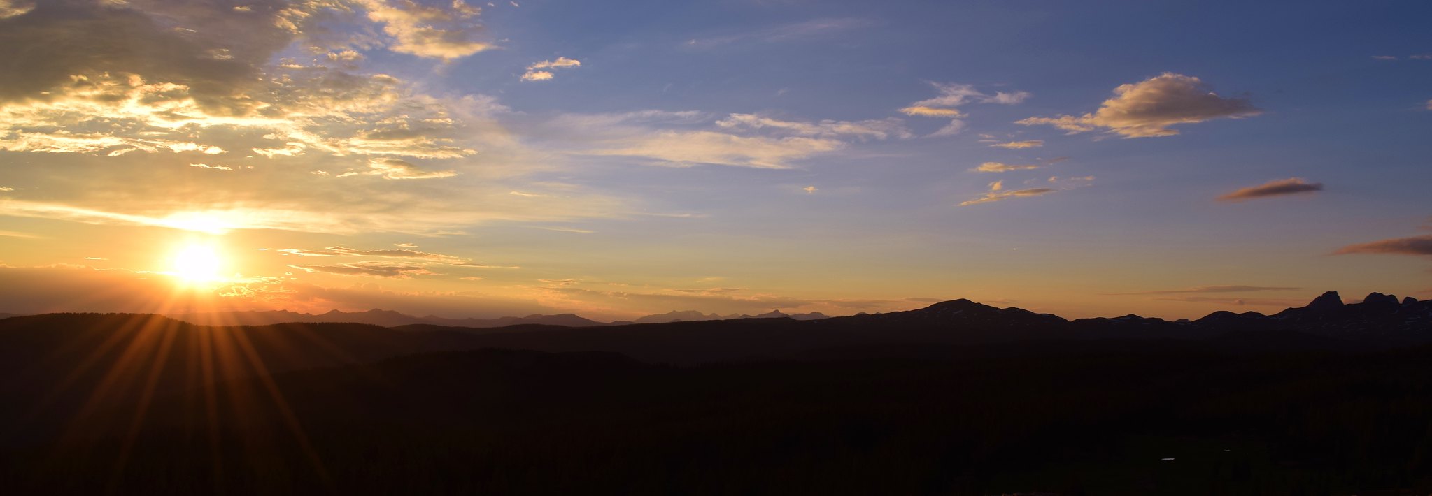
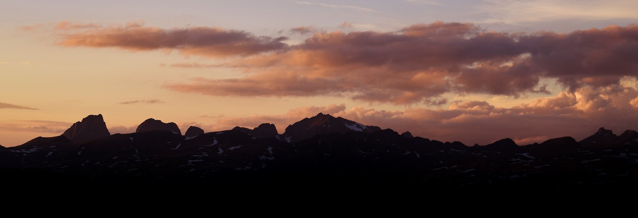
Time to retreat back to the car and find my pillow.
July 17, 2017:
5:30 AM – I didn’t take a lot of pictures as I traveled over the mesa, but I should have. The Endlich Mesa trail meanders for miles just below a handful of ranked and unranked 12ers. I followed the trail for ~ 4.5 miles to a junction. From here the Endlich Mesa trail then branches off to the west, while I proceeded another mile to the Sheridan / 12,442′ saddle along a well established side trail. Once at the saddle, I left all trails behind. A quick 1/2 mile and 700 feet later I was on top of Sheridan. Welcome to the Weminuche!
I didn’t stay long and quickly descended Sheridan’s steep north slope. Next up Sheep Mountain D, but not before the landscape completely changes.
Sheep looked pretty far off, but came quickly as I traversed up and over the western edge of hundreds of granite slabs.
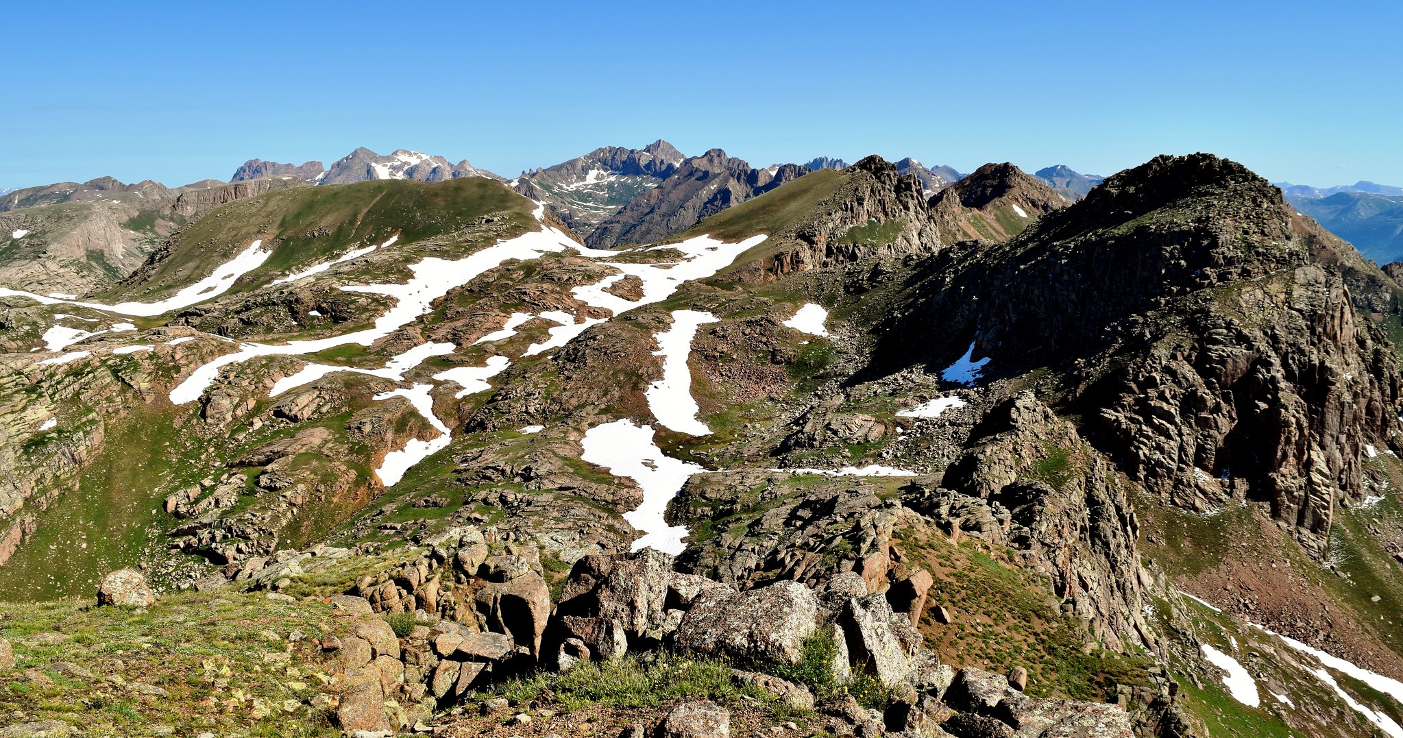
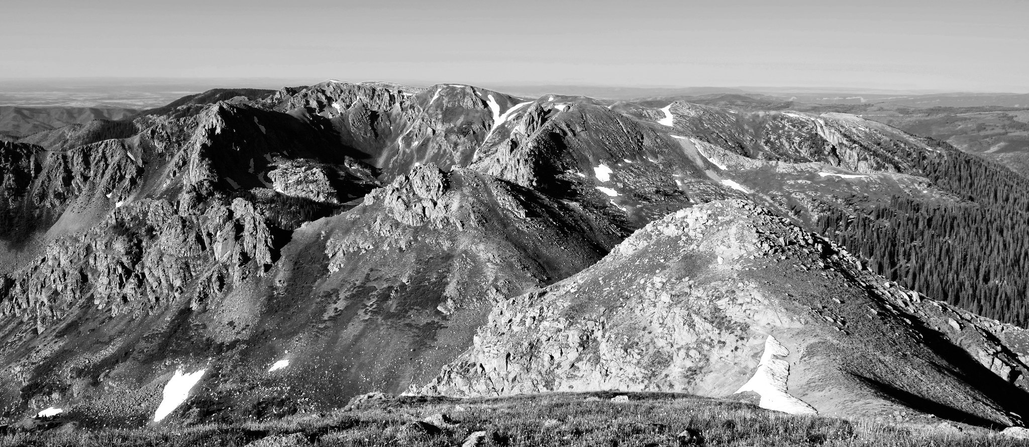
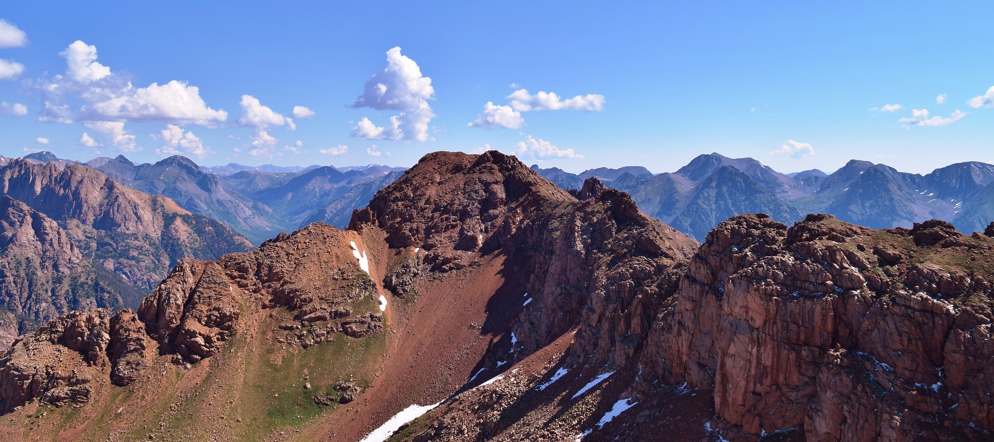
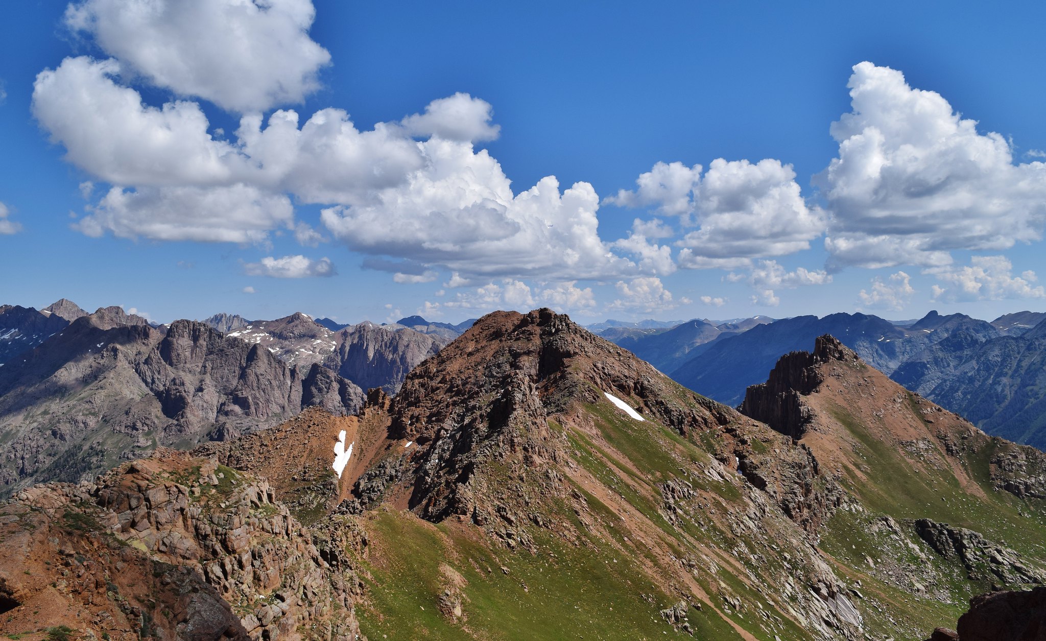
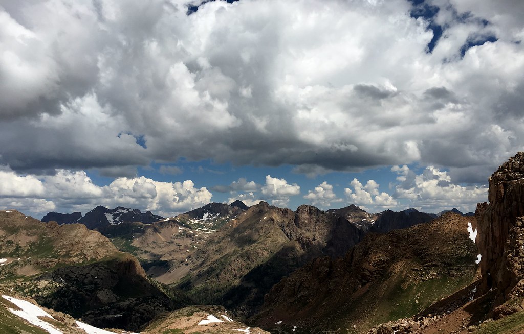
I descended Sheep to the north and west on a series of ledges. A lot easier than it looked from the summit and headed for 13,105’s north slope. Easy peasy. 300 feet later I was on top. The following are some zoomed in shots of the Oso group and it’s various drainages to the east of Vallecito Creek taken from 13,105′ and Sheep.
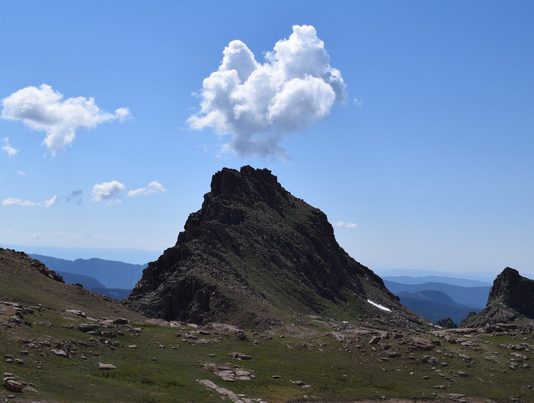
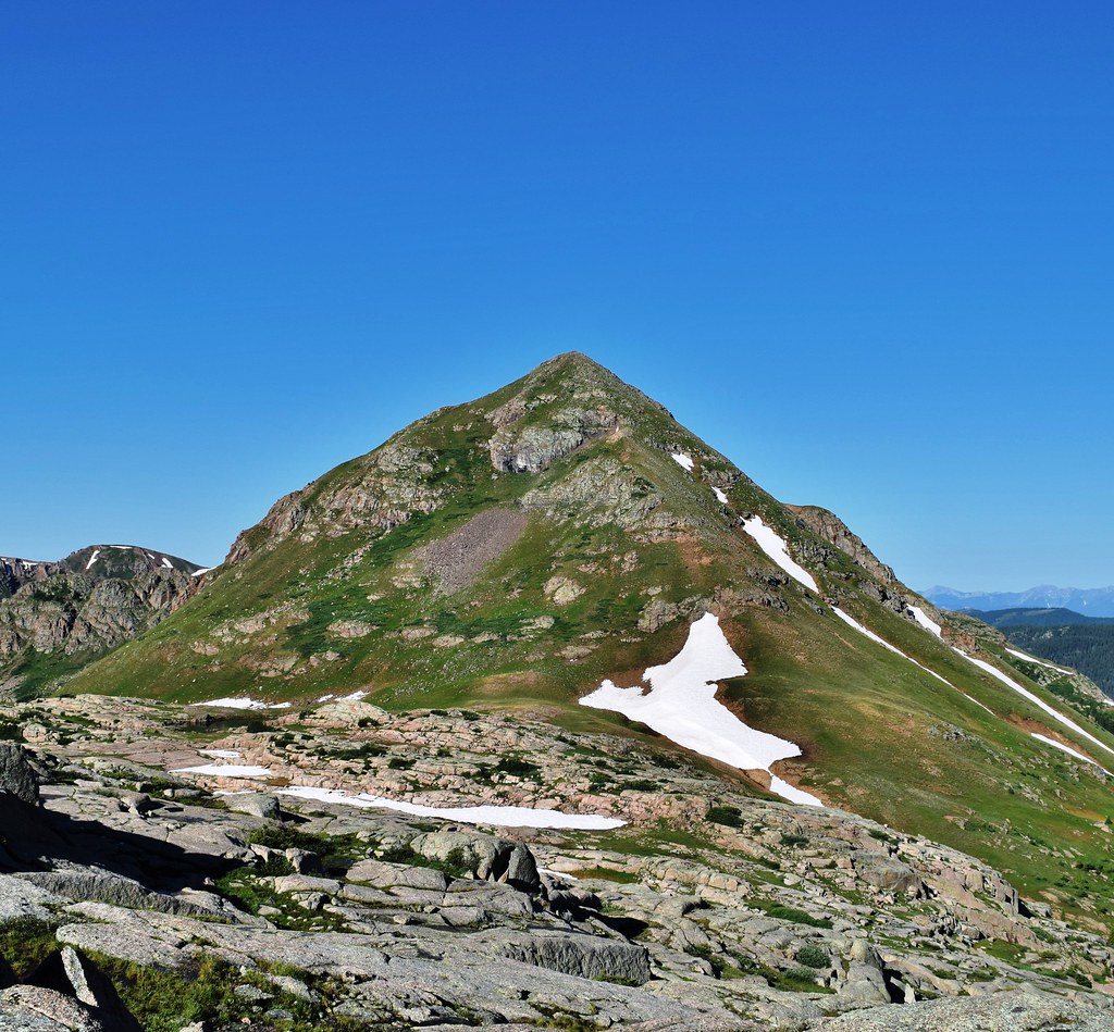
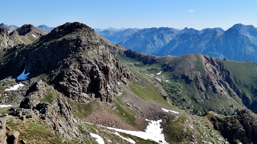
Once at the Emerson saddle it’s a few hundred feet up to each Emerson peak. First up, West. (FYI – 14ers.com calls Point 13,084 to the west of the saddle, “Peak 21”, while Trails Illustrated and the NFS call it Emerson Mountain. 14ers.com calls Point 13,140′ to the east of the saddle, Emerson Mountain, while Trails Illustrated and the NFS call it Point 13,140′. I’m just going with Emerson east and west!)
Back down to the saddle and up to Emerson – East.

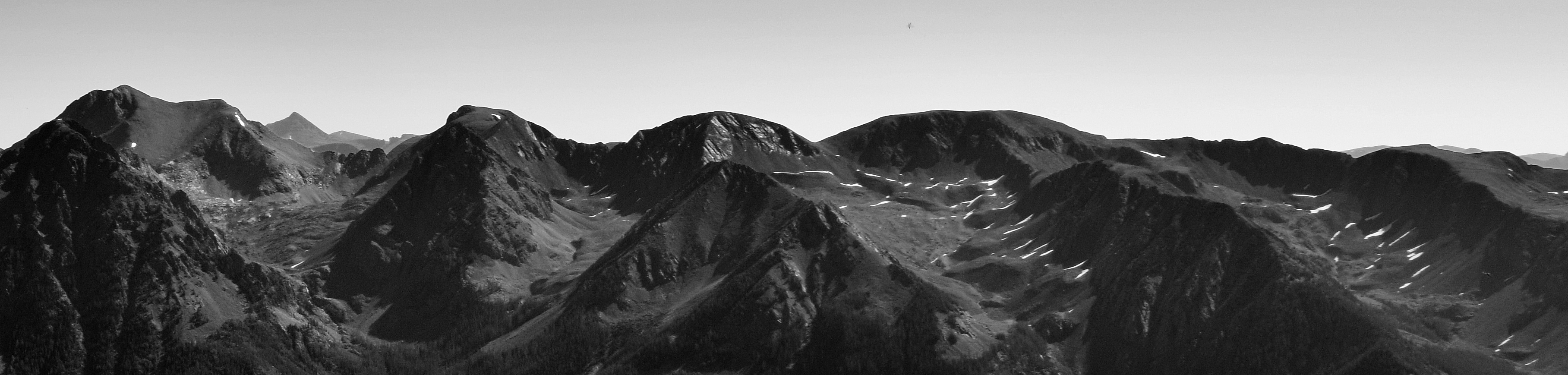
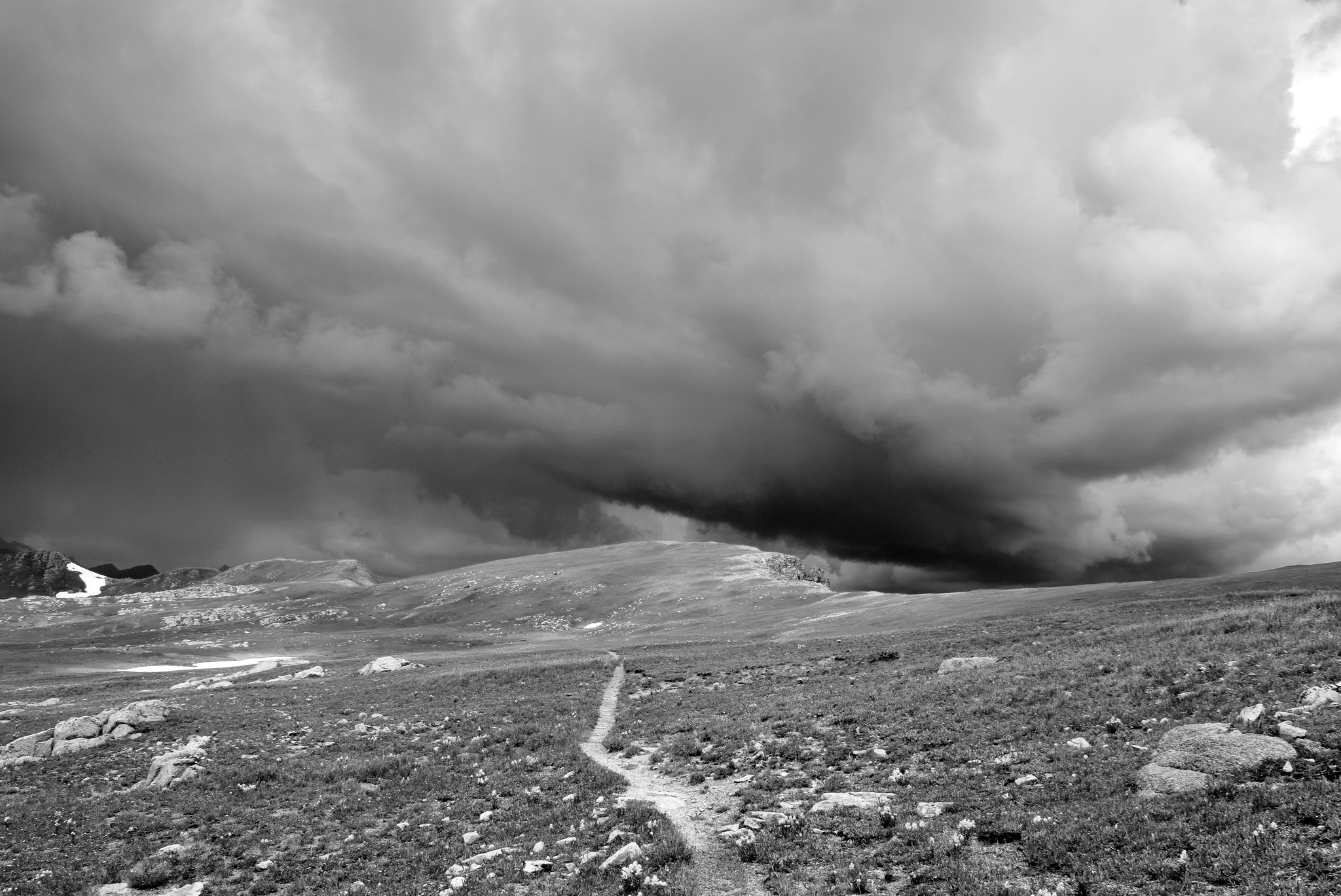
The clouds were holding so the plan from here was to hit the saddle and make my way north for Amherst. Not so fast… Welcome to the Wemi where everything can change in the 10 minutes it takes you to descend 500 feet!
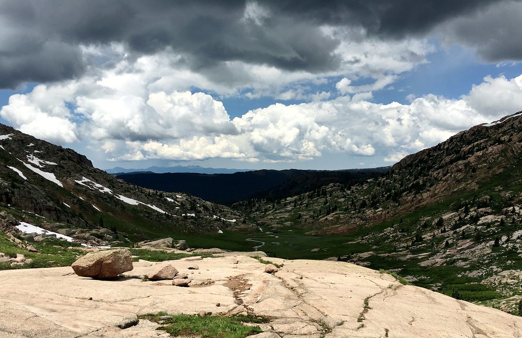
It was just before 11 AM, but knowing that I would need to summit Amherst, traverse to Organ, and then have to come back the way I came to get back into this basin, I knew those peaks were off the table. My next thought was I need to get out of here fast. I have an almost 6 mile mesa to traverse above treeline once I get back to Sheridan. For the most part the storm cooperated as I made my way lower in the basin. I bypassed Point 13,105′ and Sheep to the west and then eventually followed a game trail for the remainder to the Sheridan / 12,442′ saddle. All that I had left to cover was 6 miles to the TH. Go.
Thanks for reading! And man, it’s been way too long since I’ve written one of these. Cheers!

Nice writeup! I was curious about the Endlich Mesa approach to Amherst and Organ when I was in the area last fall, as they are nice-looking mountains viewed from Jupiter. Bummer you got stormed off before tagging them, but that’s to be expected this time of year.
LikeLiked by 1 person
Sean, thanks! You’d like the Mesa for sure. It was one of my favorite days out in a while, even solo. If I had to do it over, I might go straight for Amherst and Organ and then hit the others on the return. Hope all is good and your summer is going well!
LikeLike