
Rocky Mountain National Park is a place I like to tell myself I know a lot about, but really I probably only know a lot about very little. Other than Wild Basin, most of the Park is still uncharted territory for me. It probably always will be given the expanse. Colorado affords us so many bad @ss opportunities that I’ve found it hard to focus on one area, and in doing so, I seem to always keep the door open to all the potential that this state has to offer. However, I think I can still have a favorite or 2 or 3 or 4 and on this trip, my first trip into the Park this summer, I remembered why Rocky Mountain National Park is still tops.
Brian knows the Park better than most humans, including Rainman, and put the idea of this traverse in my head back in May on our Nokhu Hut trip. On that outing the skiers hit up Mahler and those of us who like to torture ourselves on snowshoes took on Richthofen. From the ridge on Richthofen I got my first glimpse south into all things Never Summer. From then on it was only a matter of when. The answer to that question finally came on Labor Day.
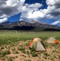
With a 1 AM departure from Denver, Brian and I arrived at the Colorado River TH a little after 3. The plan: Put on our headlamps. Hike .5 miles north to the Red Mountain Trail. Make a left and hike 3.5 miles along the largest switchback ever created to the Grand Ditch. Follow the Grand Ditch 1.7 miles north to Hitchens Gulch. Cross the Grand Ditch on a bridge (c’mon it’s a National Park) and follow the Lake of Clouds Trail to treeline. Take off the headlamps.
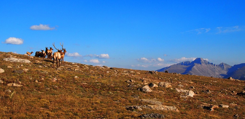
Welcome to the Never Summer Mountains! You’re all alone out here. For the rest read on…
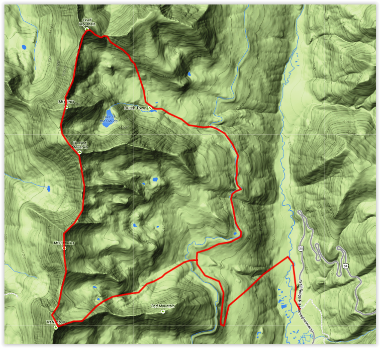
Peaks: Lead Mountain (12,537′), Mount Cirrus (12,797′), Howard Mountain (12,810′), Mount Cumulus (12,725′), Mount Nimbus (12,706′)
Date: September 1, 2014
Trailhead: Colorado River – Rocky Mountain National Park
Distance: ~ 18 miles
Elevation Gain: ~ 7,000 ft.
Participants: Brian Miller, Dillon Sarnelli
Time: 12.5 Hours

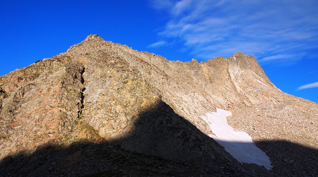
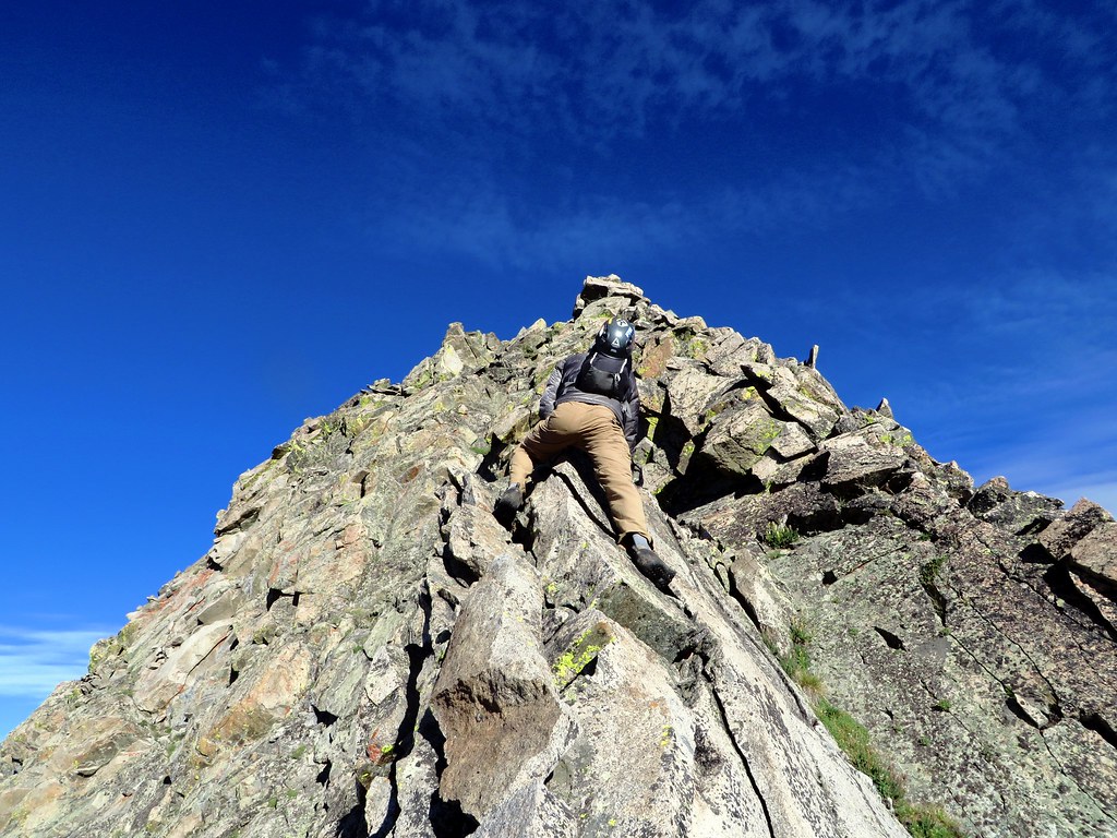
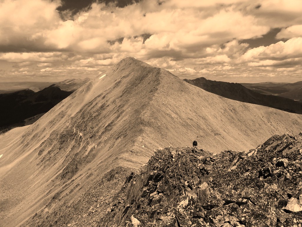
The ridge from the saddle to the summit of Lead is about .3 miles of solid Class 2+ and 3 scrambling. I would argue that near the summit it gets to Class 4 if you want it to. At one point I had to say “Miller, if we don’t stop talking I’m going to fall off into the abyss”. That is my non-textbook definition of Class 4.


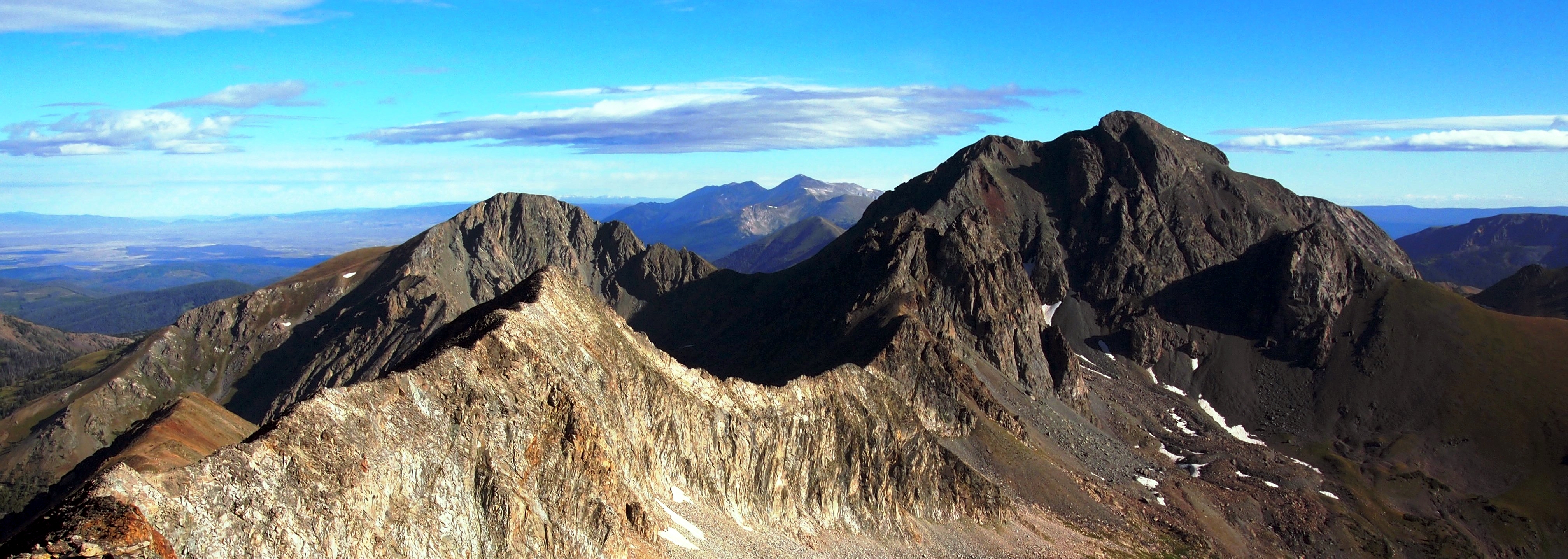
From the summit of Lead the rest is a “stroll” along the Continental Divide. The 1.1 mile traverse from Lead to Cirrus takes you over unranked “Hart Ridge”. Don’t be fooled. This is not Cirrus :). I think it’s here that we realized this wasn’t going to be a traverse in the normal sense of the word. Instead, we were legitimately climbing 5 ranked peaks. I tend to overestimate vertical gain, but if the math adds up, we averaged more than 900 ft+ between peaks.


Howard Mountain, the second tallest mountain in the Never Summer Mountains @ 12,810′ is up next. The traverse from Cirrus to Howard is a little more than one half mile. It was a nice reprieve from what we’d had up to this point and gave us a good vantage into the remainder of the route.


From the summit of Howard it’s a 1.5 mile Class 3 scramble to the giant scree pile that is Mount Cumulus. The rock is loose and we did our best to stay high on the ridge to avoid pummeling each other with boulders. It took some time and our legs were beginning to feel the enormity of the day. Miller fortunately had a Red Bull. I did not.
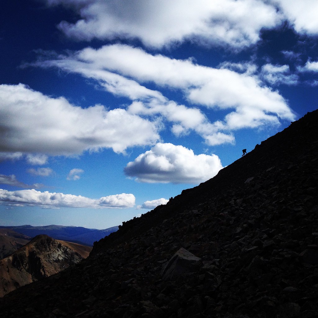

Now just one peak stood in between us and our long descent to the jeep where a few well earned Firestone Union Jacks were patiently waiting for us. Mount Nimbus, about a mile from the summit of Cumulus and 650 feet vert from the saddle was in our sights and the weather was perfect. We made quick work of it.


Summit number 5 felt pretty damn good. It was well earned and the weather was about as perfect as you would need it to be to accomplish a day like this in the summer. We sat there for a while and took it all in, reminiscing on a few past Park trips. In the end we once again came to the obvious conclusion that there really are no bad days in the Park.

 We rounded this lake on the way back to the Ditch. This spot reminded me a lot of the area around Lion Lakes in Wild Basin.

Brian, as always it was quite a day we had out there and well worth the wait to finally make this one happen. Thanks for an entertaining Happy Hour in the parking lot too, not to mention my new bottle of hot sauce! 🙂 And don’t worry, I’m pretty sure we’ll never run out of things to do in the Park. Keep Desolations, Keyhole Ridge, Ogi/Elk Tooth Traverse, and that ol’ Wild Basin/Grand Lake Traverse on the short list buddy! Until next time…

Hope you enjoyed the write-up. Thanks for reading!

This is the goods, been looking for a report on Lead mountain, super keen on trying to climb it from skeleton gulch, there’s a Class 4 section on the north ridge (according to Lisa Foster’s book) that looks like some exciting fun, and the east ridge looks fantastic as well! Great post, great pictures!
LikeLike